Home
Login
CCR Gallery
Photos from users of myccr.com
MyCCR Home Page
Album list
Last uploads
Last comments
Most viewed
Top rated
My Favorites
Search
Home
>
Canoe Routes
>
Quebec
FILE 6/201
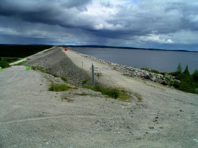
Caniapiscau Reservoir Dam
http://www.panoramio.com/map/#lt=54.838683&ln=-69.831408&k=2&z=6&tab=2
http://www.topozone.com/map.asp?lat=54.838683&lon=-69.831408&s=50&symshow=y&size=x&u=4&datum=nad83
File information
Filename:
0158LC_At_Caniapiscau_Reservoir_dam.jpg
Album name:
lllynette
/
Quebec
Rating (1 votes):
(
Show details
)
Keywords:
Caniapiscau
Photo Credit:
Lynette Chubb
Date:
July 28, 2007
Place Taken:
Caniapiscau Reservoire Dam, 54:50:19.26 N 69:49:53.07 W
Route Name:
Caniapiscau
Filesize:
335 KiB
Date added:
Feb 15, 2008
Dimensions:
1600 x 1200 pixels
Displayed:
1374 times
Digital Zoom Ratio:
0
EXIF Image Height:
1200 pixels
FlashPix Version:
version 1
ISO:
64
Resolution Unit:
Inch
Saturation:
0
Y Resolution:
72 dots per ResolutionUnit
YCbCrPositioning:
Datum Point
URL:
http://gallery.myccr.com/displayimage.php?pid=1536
Favorites:
Add to Favorites


![0167LK_[373.5]_Sunrise_over_Pekans.jpg](albums/userpics/10087/thumb_0167LK_%5B373.5%5D_Sunrise_over_Pekans.jpg "Filename=0167LK_[373.5]_Sunrise_over_Pekans.jpg
Filesize=312KiB
Dimensions=1280x960
Date added=Jan 18, 2008")


